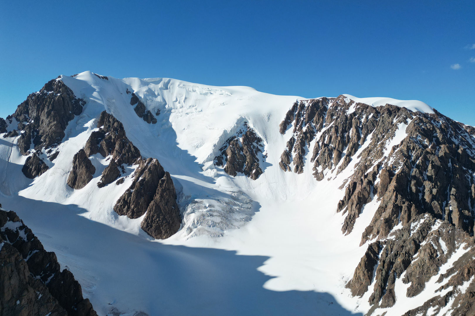
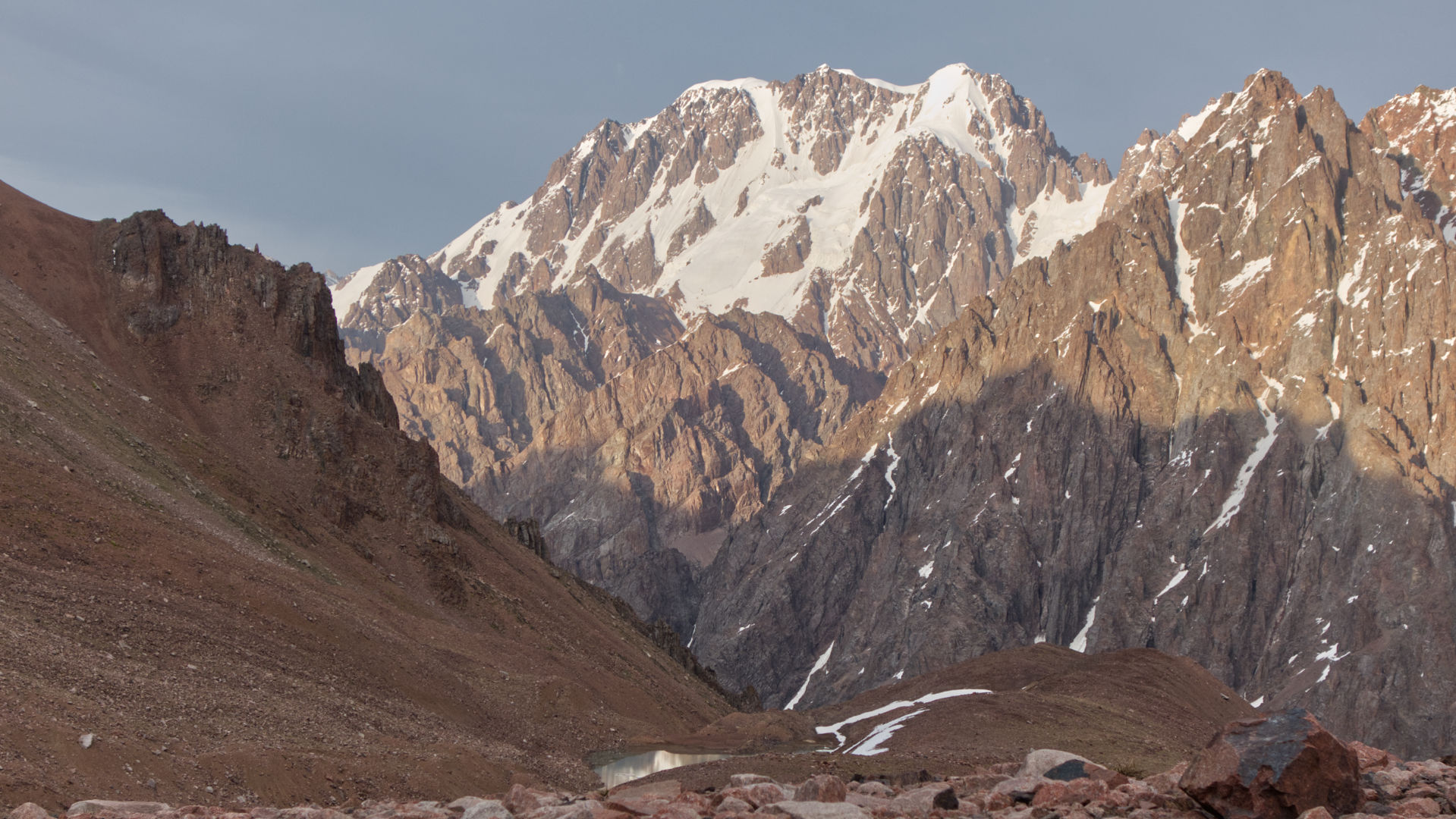
Talgar, 4979, is the tallest mountain in the whole Ile Alatau Range. It’s located near Almaty—the biggest city of Kazakhstan. It is almost 5000 meters high, much higher than any other mountain in the area.
In the southeast, it holds a massive amount of ice, which gently joins the biggest glacier of the range—Korzhenevskogo. From the northwest, steep ice slopes start from a beautiful Middle Talgar gorge.
We offer two routes: Classic from the South and Hard from the West.
Classic Talgar route
Day 1. Our trek starts at beautiful Issyk Lake. From there, we follow the trail next to the Issyk River. We finish this day at the shady meadow where the river springs from the rock.
Day 2. After some walking on a good trail through the forest, we’ll reach a wide open basin of Boskol. From there, we’ll climb a steep ancient moraine and witness Akkol Lake with snowy mountains in the background. After Akkol, we’ll hike to the alpine meadows of Ryskul Valley.
Day 3. From the bottom of the valley we’ll ascend to Kokbulak pass. From there, we’ll climb a non-technical route onto Kokbulak, 4555m. From the summit, we’ll see the goal of our journey—Talgar itself. After descending from the summit to the pass, we’ll slide down the scree to a wide, flat meadow just above the glacier—Paradise Meadow.
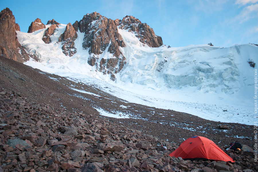
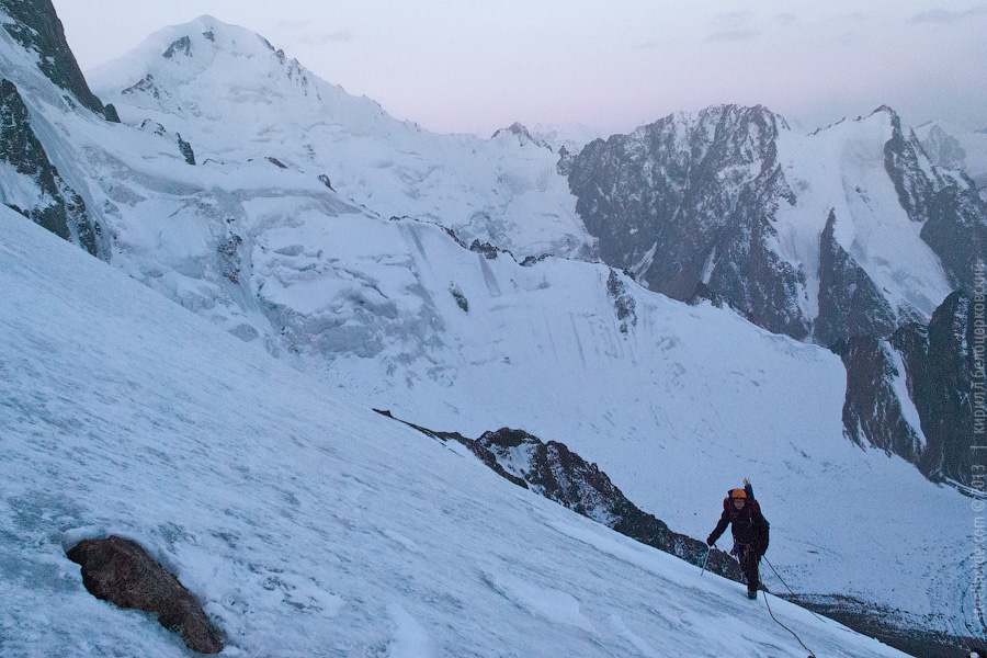
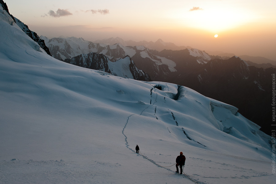
Day 4. From the Meadow, we’ll walk down to the glacier. Here, it is still safe to walk unroped, but after an hour of walking, we’ll have to use ropes and other gear as the crevasses start to cross the glacier. At noon, we’ll reach Gorin Glacier—a place for the camp and a starting point for the summit push.
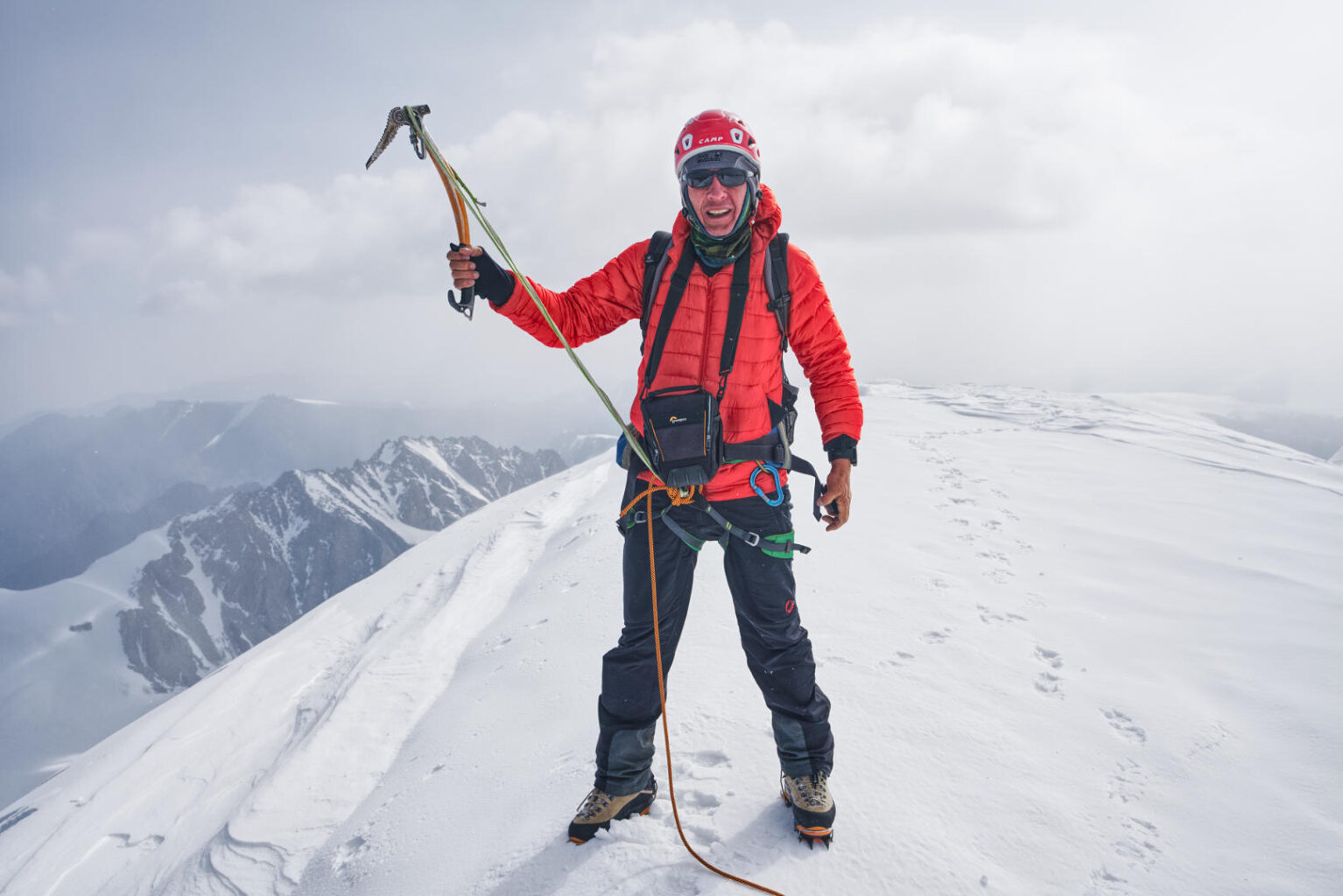
Day 5. We’ll start early, well before dawn. This will let us walk on the snow while it’s still solid, and also, in this case, we’ll have enough time to climb the mountain at a comfortable pace. Upon reaching the base of the route, we’ll cross a bergshrund and climb a steep snow and ice slope. After a while, we’ll pull up onto the summit ridge. After a break at the summit, we’ll descend along the way of ascent.
Day 6. From the Gorina Glacier, we’ll return to Kokbulak Pass, cross it, and hike down to Akkol Lake. We’ll stay for the night at the lake.
Day 7. From Akkol, we will descend into Issyk Valley. Depending on your condition, we can either return to the cars or camp one more night near the river.
Days 8 and 9. We can use additional days to wait out in bad weather or rest if needed.
Here is a video, showing the route:
This route is for you if you:
- Prefer moderate to technical terrain
- Want to see more on the approach
Non-classic Talgar Route (Antishin route)
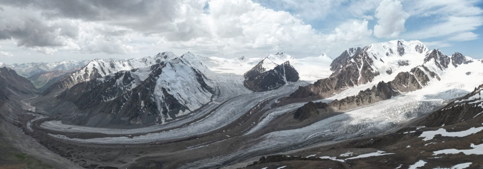
In this case, we’ll approach the mountain through another valley—Middle Talgar. The approach is shorter and less strenuous, but the route is much longer and requires excellent physical shape.
Day 1. We start from the end of the road in Talgar Valley. After an hour or so of walking, we’ll turn right to enter Middle Talgar Gorge and follow its bushy trails for most of the day until we reach an abandoned Talgar camp. We will stay for the night in one of the camp’s buildings.
Day 2. We’ll roll out of the forest area on a good trail. After crossing an ancient Moraine called Annapurna (the same name as a Himalayan mountain), we’ll hike more and then turn towards the South Talgar glacier. A moraine will lead us to the plateau at the upper part of the glacier, where we’ll make our base camp.
Day 3. Acclimatization and load carrying. We’ll climb a scree slope up to a notch between Talgar and Klyshtau. From there, we’ll climb Klyshtau for acclimatization. After the climb, we’ll leave our gear at the notch and slide down the scree to the camp.
Day 4. We’ll start at night to have as much time at our disposal as possible. From the notch we’ve been before, we’ll climb up our intended route on snow and ice. After reaching a cwm at approximately half the height of the route, we’ll turn left and follow an ice slope up to the ridge. The ridge will lead us to the summit. The descent will take a fair bit of time, as we’ll have to retrace our way back to the notch and down to the tents.
Day 5. Depending on your condition, we can either go down to the cars in one long, exhaustive push or stay for the night in Talgar camp.
Days 6 and 7. Finishing the trek and additional days to wait out the weather or rest before the summit day.
This program will fit you if you:
- In perfect physical shape
- Familiar with multi-pitch rappels
- Ready to have at least one long but unforgettable day
Gear to climb Talgar
- Helmet
- Headlamp
- Harness
- Lanyard (a sling or dedicated one)
- Rappel device
- 3 locking carabiners
- Prussik loop
- 120 cm sling
- Ice axe (classic or technical)
- Crampon compatible boots
- Crampons
- 60–80 liters backpack
- Trekking poles
- Sleeping bag with the temperature of comfort around 0 °C
- Sleeping mat
- Bowl + cup + spoon
- Bottle or thermos
- Sunglasses
- Sunscreen
General info
All members must have insurance, which covers mountain accidents. Talgar is serious mountain, treat with respect. We’ll do everything to keep you safe, but mountains are full of uncertainities by their nature.
All members carry their gear and share part of the group’s weight (food, tents, etc.). If you want to avoid carrying a heavy pack, let us know in advance. We’ll find porters who, for an additional fee, will help with the loads.
Talgar is located on a therritory of Almaty Natural Reserve. Obtaining permits is mandatory, keeping the site clean and untouched even more important.
We can provide climbing gear for both climbs: a helmet, harness, crampons, carabiners, and an ice axe if you book in advance.